Matrice 4 - Two Models, Countless Applications

DJI MATRICE 4T
Wide-Angle Camera
1/1.3″ CMOS, 48MP Effective Pixels, f/1.7, Format Equivalent: 24 mm
Medium Tele Camera
1/1.3″ CMOS, 48MP Effective Pixels, f/2.8, Format Equivalent: 70 mm
Tele Camera
1/1.5″ CMOS, 48MP Effective Pixels, f/2.8, Format Equivalent: 168 mm
Laser Range Finder
Measurement Range: 1800 m (1 Hz); Oblique Incidence Range (1:5 Oblique
Distance): 600 m (1 Hz) Blind Zone: 1 m; Range Accuracy (m): ± (0.2 +
0.0015 × D) [1]
Infrared Thermal Camera
Resolution 640 × 512, f/1.0, Equivalent Focal Length: 53 mm, Uncooled VOx Microbolometer, Supports High-Res Mode
NIR Auxiliary Light
6°, Illumination Distance: 100 m

DJI MATRICE 4E
Wide-Angle Camera
1/1.3″ CMOS, 48MP Effective Pixels, f/1.7, Format Equivalent: 24 mm
Medium Tele Camera
1/1.3″ CMOS, 48MP Effective Pixels, f/2.8, Format Equivalent: 70 mm
Tele Camera
1/1.5″ CMOS, 48MP Effective Pixels, f/2.8, Format Equivalent: 168 mm
Laser Range Finder
Measurement Range: 1800 m (1 Hz); Oblique Incidence Range (1:5 Oblique
Distance): 600 m (1 Hz) Blind Zone: 1 m; Range Accuracy (m): ± (0.2 +
0.0015 × D) [1]


Intelligent Operations
Smarter Operations
The Matrice 4 built-in model can detect vehicles, vessels, and subjects during search and rescue operations or routine flights. It also supports switching to other models, enabling the expansion of application scenarios. Additionally, it supports high-res grid photos and features powerful tracking capabilities.
Laser Range Finder, Precise Measurement
The laser range finder enables real-time precise measurement. Through simple operations such as pin point, line drawing, and area calculation, it can complete tasks like marking target locations for inspection purposes or calculating the area of a wildfire. Additionally, users can share info via the DJI Pilot QR code or FlightHub 2 with relevant personnel to enhance collaboration and workflow efficiency.
Observation Range Recording
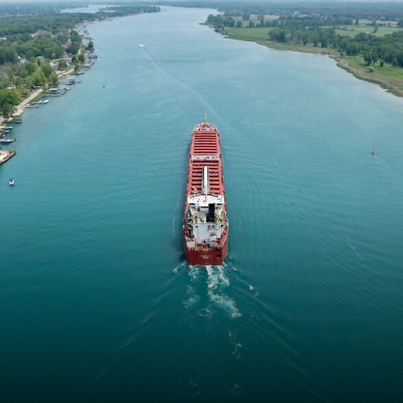
DJI Pilot 2 can highlight the center position of the camera frame and ground area observed. It can display the surveyed area on the map, making it especially useful for patrols, and rescue operations in mountainous terrain without clear landmarks.
Activate cruise control mode to pilot the drone in a specific direction without
constantly pressing the control sticks, making long-distance flights
easier.
In emergencies or disasters, the drone can automatically adjust its flight
path and speed based on the surrounding environment, allowing it to
reach a designated location without manual adjustments.
Smart Track allows for precise subject positioning and automatic zoom
adjustments, allowing you to switch between subjects easily. It can
automatically reacquire a subject even if obscured briefly.
POI enables continuous observation and 3D modeling of buildings while
flying around a designated area, greatly enhancing the efficiency of
fixed-point observation and modeling tasks.
Capture Every Detail at A Distance With Matrice 4
Enhanced Medium Telephoto
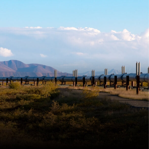
The Matrice 4 series is equipped with a medium tele camera, expanding its capabilities for medium-range inspection tasks. During power line or bridge inspections, it can detect screws and cracks from a distance of 10 meters and clearly read instrument data at substations. [6]
Super Resolution Telephoto
The tele camera of the Matrice 4 series has significantly improved clarity, featuring 48 MP resolution, capable of capturing incredibly details from signs up to 250 meters away. [7] Additionally, the Matrice 4T is equipped with an IR-Cut Filter, ensuring 24/7 operations.
Foreground Stabilization for Telephoto Imagery
The upgraded telephoto stabilization makes foreground subjects stable and clear during telephoto shooting at 10x zoom or higher. In scenarios such as public safety and inspections, subject details are clearly visible.
Electronic Dehazing, Clear as Ever
In conditions such as smog or atmospheric humidity, Electronic Dehazing supports three modes (Low, Medium, High) to improve the imaging clarity of the Matrice 4 series to match different operational environments and requirements.
Precision Mapping, Time-Saving and Effortless
Rapid 0.5-Second Interval Shooting
The Matrice 4E wide-angle camera supports rapid 0.5-second interval shooting in both orthophoto and oblique photography modes, enabling high-speed aerial surveying from multiple angles. Additionally, the mapping flight speed can reach up to 21 meters per second, [8] significantly enhancing work efficiency.
Multi-Directional Capture, Efficiency Multiplied
5-Directional Oblique Capture
The Matrice 4 series supports a new 5-directional oblique capture. The gimbal can intelligently rotate and shoot at multiple angles based on the survey area, achieving the effect of multiple shots in a single flight compared to previous models, significantly enhancing the efficiency of small drone oblique photography.
3-Directional Ortho Capture
Matrice 4E supports 3-directional ortho capture, enabling lateral capturing while performing ortho collection tasks, which reduces lateral overlap. A single flight can complete mapping operations for an area of 2.8 square kilometers. No additional elevation optimization flight route is required to achieve better elevation accuracy. Combined with new DJI Terra capabilities, it further enhances reconstruction efficiency while ensuring quality.
Smart 3D Capture, Precision Modeling
DJI Matrice 4E supports Smart 3D Capture, which allows you to capture and create a rough model on the remote controller. Based on the rough model, it can quickly generate precise mapping routes close to a structures surface, completing detailed measurements and modeling of irregular buildings. It also supports displaying virtual space routes and waypoint photos for smart 3D capture, making it convenient to assess specific routes' flight safety and coverage area.
High-Precision D-RTK 3 Multifunctional Station
The D-RTK 3 Multifunctional Station can serve as a base station to provide centimeter-level positioning for multiple drones simultaneously or extend the operational range of drones in relay station mode*. Additionally, the new Rover Station Mode, combined with the DJI Enterprise app and DjI Terra, provides a comprehensive solution for high-precision aerial surveying applications, ensuring a secure and accurate operation.
DJI RC Plus 2 Enterprise
DJI RC Plus 2 Enterprise remote controller features a new high-
brightness screen that remains clearly visible even in direct
sunlight. It has an IP54 protection rating and can operate in
temperatures ranging from -4°F to 122°F (-20°C to 50°C). Using the
04 Enterprise video transmission system, it features a built-in high-
gain antenna array, providing strong performance. It also supports
04 Enterprise and 4G hybrid transmission solutions, ensuring
stable and smooth video transmission in urban high-rise areas and
mountainous environments.
DJI Cellular Dongle 2 [14]
The DJI Cellular Dongle 2 offers 4G network video transmission and
can work together with the 04 Enterprise video transmission
system, ensuring safe flights in complex environments.
Additionally, it provides mobile network connectivity for the remote
controller.
DJI Power 1000
DJI Power 1000 can provide up to 200W fast charging for Matrice 4
Series intelligent batteries, 20) fully charging one battery in 48
minutes. (21] It also offers 2200W AC output, ensuring a reliable and
stable power supply for outdoor operations. Additionally, it can be
paired with the DjI Power 1kW car charger, allowing for 1kW fast
charging, supporting outdoor operations with continuous power
and uninterrupted journeys.
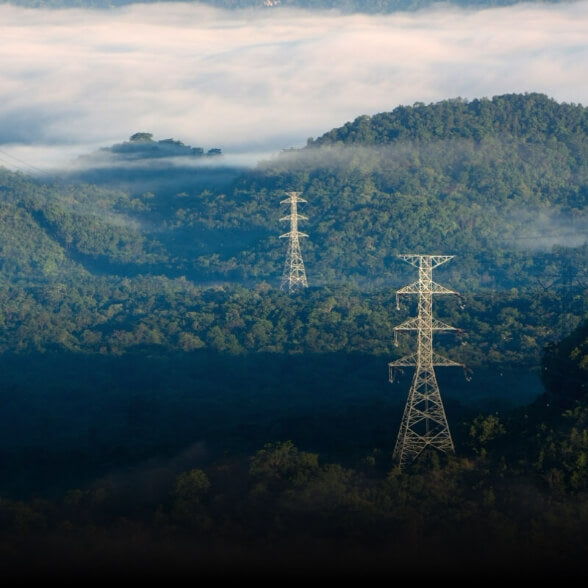
Safe Flight, Worry-Free Operation
Fusion Positioning, Safe Return-to-Home
The Matrice 4 series comes with an integrated DJI RTK module which supports the extended L5 frequency band and features GNSS+Vision Fusion Positioning and Navigation System. It allows for the return-to-home point to be updated through visual positioning, allowing for rapid takeoff within 15 seconds. Even without GNSS signals, it can complete the return-to-home process, effectively overcoming signal obstructions and interference commonly found in urban environments.
Intelligent Guidance, Unobstructed Flight
When the DJI RC Plus 2 Enterprise remote controller is connected to the internet, it can load terrain elevation maps and preload detailed maps. This enables automatic path planning for obstacle avoidance, effectively managing scenarios such as flying at night or through mountainous areas, ensuring the safety of flight operations. The drone has a 5-directional vision assist view system along with downward vision, which aids in providing comprehensive visibility for enhanced protection.
Achieve New Heights in Video Transmission
The O4 Enterprise video transmission system sets a new industry standard for challenging environments. Thanks to the 8-antenna system in the Matrice 4 Series and the high-gain antenna in the remote controller, you can achieve up to 25 kilometers in transmission range. Furthermore, the system improves image transmission with a download bandwidth of 20MB/s, more than double the bitrate of the Mavic 3 Enterprise Series, ensuring more precise and stable images of route uploads and material downloads.
Accessory Upgrades, Performance Leap
Gimbal-Following Spotlight
The DJI AL1 SpotLight can illuminate subjects up to 100 meters away, [16 and features two modes, Always-On and Strobe. It can connect with the gimbal, enabling it to follow the camera's movements to ensure the illuminated area aligns with the camera's view. Additionally, the spotlights can focus on a single object or offer a wide field of view (FOV) which illuminates up larger areas.
Real-Time Voice Speaker
The DJI AS1 Speaker offers impressive sound power and
extensive range. It has a broadcast range of up to 300 meters
and can produce a volume of up to 114 decibels at a distance
of 1 meter. 117 It supports recorded messages, media
imports, and text-to-speech conversion. 1181 Additionally, it
features real-time broadcasting and echo suppression, (19)
enhancing the efficiency and flexibility of emergency search-
and-rescue operations.
Software Designed for Industries
DJI Pilot 2
DJI Pilot 2 interface has been comprehensively updated, featuring a customizable intelligent function toolbar and support for various types of flight routes. Additionally, it includes virtual space models and route preview functions, 221 making operations more convenient and efficient. It can connect with FlightHub 2 to enhance drone control operations and facilitate cloud information sharing, therefor reducing the workload of frontline pilots.
DJI FlightHub 2
Specifically for the Matrice 4 series aircraft, DJI FlightHub 2
has been upgraded for remote control, allowing a variety of
flight route planning functions, including remote takeoff and
landing, Smart 3D Capture routes, geometric routes, and
slope routes. Operators can control both the payload and the
aircraft simultaneously through Live Flight Controls features.
During multi-drone operations, operators can synchronize
multiple livestreams on a single screen, creating a new
efficient air-ground operation experience.
DJI Terra
DjI Terra enables high-precision camera distortion correction
for the Matrice 4E. It supports free offline PPK processing of
visible light images and allows for importing D-RTK 3 data,
which enhances reconstruction accuracy. The software
provides rich 2D, 3D, and point cloud model data, catering to
various applications such as geographic information,
emergency response, and construction planning.
DJI Modify
DjI Terra enables high-precision camera distortion correction
for the Matrice 4E. It supports free offline PPK processing of
visible light images and allows for importing D-RTK 3 data,
which enhances reconstruction accuracy. The software
provides rich 2D, 3D, and point cloud model data, catering to
various applications such as geographic information,
emergency response, and construction planning.
DTAT 3.0
After completing thermal imaging operations 2) with Matrice
4T, you can use the DTAT 3.0 thermal analysis tool to mark,
analyze, and process images, detecting abnormal
temperature points.
Open Developer Ecosystem
Intelligent Algorithm Developer
Provides the necessary model training tools and third-party developer certification process to access onboard computing capability, helping expand new drone intelligent algorithm application fields.
PSDK
E-Port and E-Port Lite encryption authentication ensure secure and worry-free payloads, enabling the Matrice 4 Series to have broader application scenarios.
MSDK
Mobile SDK 5 simplifies the development of apps to control the Matrice 4 Series. Mobile SDK 5 is fully open source and comes with production code samples of core DJI Pilot 2 modules, ensuring its reliability.
Cloud API
With DJI Pilot 2's built-in Cloud API (MQTT-based protocol) you can directly connect the Matrice 4 Series to third-party cloud platforms. Access the drone's hardware, video live-stream, and photo data without having to develop an app.
DJI Terra API
With the DJI Terra API, users can integrate its powerful mapping capabilities into their own platforms, achieving automated 2D and 3D reconstructions. Additionally, users can customize photogrammetry workflows as needed, allowing the Matrice 4E's operational results to meet the needs of various industry applications better.
User Data Security


Local Data Mode

One-Tap Clear All Device Data

AES-256 Video Transmission Encryption

Cloud API
Get 1 Year of DJI Care Enterprise Plus or 1 Year of Official Extended Warranty Service for Free
DJI Care Enterprise Plus
Comprehensive Protection | Professional Quality Assurance | Exclusive Service | Service Starts with Activation
Free Repairs
Unlimited number of free repairs within the coverage limit.
Flyaway Coverage
1 time/year, worry-free operation
Coverage for Your Whole Fleet
Shared limit for maximum protection
Free Shipping
Free Mail-in Repairs, Hassle-Free Service
Extended Warranty Service
During the service period, the main parts remain covered by the official warranty, bringing longer protection for your product.


The Age of Intelligent Flight

Matrice 4T